The Faroe Islands reward travellers who plan around a small set of hard constraints rather than those who wing it. The country is 18 volcanic islands strung between Iceland and Norway, linked by a road and tunnel network that is more sophisticated than the population of roughly 55,000 would suggest, and by ferries that run on genuinely limited schedules. The decisions that shape a trip here are not about which sights to skip, since almost everything is reachable in a week, but about when you go, how you get between islands, how you budget for tunnel tolls and one regulated hiking fee, and how you plan around a country that still closes most of its shops on Sunday.
This guide works through those decisions in order: getting to the islands, getting around once you land, the single most talked-about regulated site (Mykines and its puffins), the free landmarks that anchor most itineraries, and the weather and closures that catch first-time visitors off guard.
Getting there: Atlantic Airways or the Smyril Line ferry
Almost everyone arrives by air. Atlantic Airways, the national carrier, flies into Vágar Airport (FAE) year-round from Copenhagen multiple times a day and from Billund and Aalborg in Denmark, plus scheduled routes from Edinburgh, Paris, Oslo, and Reykjavík, with seasonal summer links to Barcelona and Mallorca. Reykjavík to Vágar is a short hop, which makes combining the Faroes with an Iceland ring road trip straightforward for anyone building a longer North Atlantic itinerary. The alternative is slower and more of an event in itself: Smyril Line's car ferry, the M/S Norröna, sails year-round from Hirtshals in Denmark to Tórshavn in roughly 30 hours, continuing on to Seyðisfjörður in Iceland during the summer season before returning south via the Faroes again.
The ferry makes sense mainly for anyone bringing a car from mainland Europe or building a slower Denmark-Faroes-Iceland loop; flying is faster and, for most, cheaper once car hire is factored in separately.
Getting around: a rental car, and the tolled sub-sea tunnels
A hire car is close to essential. Public buses connect the main towns, but the outer villages and trailheads that make the Faroes worth the trip run on infrequent schedules that do not suit day-tripping. Once you are driving, the network of more than 20 tunnels is the thing to understand: the four sub-sea tunnels linking the main islands (Vágatunnilin to the airport island, Norðoyatunnilin to Klaksvík, Eysturoyartunnilin including the widely photographed undersea roundabout, and Sandoyartunnilin) all charge a toll, while the roughly 19 mountain tunnels that burrow through hillsides rather than under the seabed are free to use.
As checked in July 2026, one-way toll rates for a standard car without a subscription are DKK 50 for Vágatunnilin and Norðoyatunnilin (charged as a return fee when driving from Vágar or Klaksvík respectively) and DKK 175 for Eysturoyartunnilin and Sandoyartunnilin, with motorcycles travelling free through Vágatunnilin and Norðoyatunnilin; a single-trip toll payment must be settled online within six days of travel, after which a DKK 50 late fee and an invoice follow. [2]
Tolls are collected automatically: a camera photographs the number plate as you drive through without stopping, and you settle the charge afterwards. If you have a Faroese rental car, the rental company typically bills tunnel tolls directly to your account, so it is worth asking at pickup rather than assuming you need to register separately. If you are not using a rental company's automatic billing, you register your plate and pay per trip, or set up a short-term automatic payment, at tunnil.fo.
Mykines and the puffins: a regulated island, not a free-for-all
Mykines is the westernmost inhabited island and the single most reel-famous stop in the country, largely because it holds the country's most accessible large puffin colony. It is also the most tightly managed site in the Faroes. Landowners on the island, working with the regional tourism board Visit Vágar, introduced a formal protection plan that caps the island at 200 visitors at a time and restricts access to the outfield, where most puffins nest, to certified Faroese guides only.
As checked in July 2026, Visit Vágar's Mykines protection plan sets a maximum of 200 visitors on the island at once and limits outfield access, where most puffins are found, to the hours of 10:00 to 17:00. [1]
The practical upshot: walking the public path through the infields near the village is free and requires no guide, but anyone wanting to reach the puffin-covered outfield slopes needs a guided tour arranged through the landowners' association or a licensed operator. Booked in advance through hiking.fo, that guided hiking fee runs to DKK 400 per person; paying on arrival costs DKK 500, and the fee applies to everyone over 15. Foreign guides without a Faroese work permit are barred from leading tours on the island, so third-party operators must contract a certified local guide.
Visit Vágar's protection plan frames the limits as necessary for sustainable tourism given the island's fragile terrain, capping the number of people on Mykines at any one time and restricting outfield hiking, where the puffins nest, to guided access only.
— Paraphrased from Visit Vágar's official Mykines protection plan
The path to Mykineshólmur and its lighthouse, the classic postcard shot, is closed for the whole nesting season from May to September to protect breeding puffins, and separately due to landslide risk near an area called Lamba; the realistic endpoint for visitors during summer is the viewpoint at á Rógvu, from which the lighthouse and birdlife are still visible. Getting to the island at all depends on the SSL ferry (route 36) from Sørvágur, which runs a limited summer timetable with only a handful of daily return sailings and needs booking well ahead in peak months, or Atlantic Airways' small helicopter service, which flies only a few times a week and sells seats just seven days before departure.
- Decide before you travel whether you only want the free infield walk or the guided outfield hike to the puffin slopes, since the fee and guide requirement only apply to the latter.
- Book the SSL ferry to Mykines and any guided hiking fee in advance through hiking.fo where possible, since it is discounted versus paying on arrival.
- Do not plan on reaching the lighthouse on Mykineshólmur between May and September; the path is closed for the nesting season.
- Build a weather buffer day into any Mykines plan, since both the ferry and the alternative helicopter are weather-dependent and cancellations are common.
- Check current fees and hours directly with Visit Vágar shortly before travel, since visitor caps and pricing are reviewed periodically.
The free landmarks: Múlafossur, Saksun, and Tjørnuvík
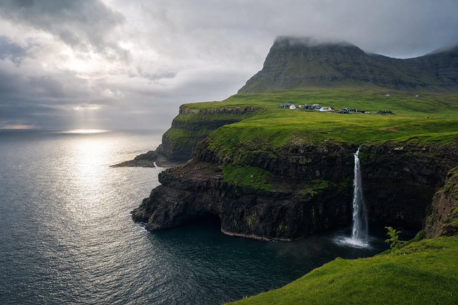
Not everything iconic in the Faroes comes with a fee or a booking system. Múlafossur, the waterfall that drops directly into the North Atlantic beside the village of Gásadalur on Vágar, is reached by a short, paved, five-minute walk from a free car park, with no admission charge and no guide requirement. It was cut off from road access until a mountain tunnel opened in 2006, and it remains one of the most photographed single spots in the country precisely because the walk to it is so undemanding relative to the drama of the view.
Saksun, a hamlet built around a tidal lagoon on Streymoy, and Tjørnuvík, a black-sand beach village at the island's northern tip framed by the twin sea stacks Risin og Kellingin, are similarly free to visit and simply require the drive out; both sit at the end of single roads rather than through routes, so they are detours rather than waypoints, worth allocating a half-day rather than trying to combine with a full loop elsewhere. Anyone comparing this style of dramatic, low-infrastructure coastal scenery against other North Atlantic islands might also look at the Lofoten Islands, which share the pattern of free landmarks paired with a car-dependent, tunnel-and-ferry road network.
Weather and packing: four seasons in one day
The islands' own tourism board is blunt about this: the weather, not the itinerary, runs the show. Conditions can shift from fog to rain to sun within the same afternoon, and the difference between a calm coastal walk and a genuinely unsafe one can be a matter of an hour. Officially recommended precautions include checking local forecasts before heading beyond the capital, never hiking alone in remote areas without notifying someone of your plans, and keeping a phone charged for the duration of any hike.
As checked in July 2026, official guidance describes the Faroe Islands as a place where all four seasons can occur on the same day, and recommends checking local weather conditions before travelling to villages outside the capital and always notifying someone of your plans before a hike. [6]
Sunday closures and the rhythm of the week
Faroese retail still runs on a schedule that surprises visitors used to seven-day shopping. Most shops, including grocery stores, are closed on Sundays, and even on other days hours are shorter than many travellers expect: roughly 10am to 6pm on weekdays and 10am to 2pm on Saturdays, varying by location. For a Sunday in a smaller village, that generally means petrol stations and their attached kiosks are the most reliable source of food and supplies, while restaurants in Tórshavn are more likely to stay open than shops.
As checked in July 2026, most Faroese shops, including grocery stores, are closed on Sundays, with typical opening hours running 10am to 6pm on weekdays and 10am to 2pm on Saturdays. [5]
Building a Sunday around a hike, a scenic drive, or a museum rather than a shopping stop avoids the disappointment of arriving in a quiet village to find the doors locked. Stocking up on Saturday afternoon before the shorter weekend hours, particularly if self-catering outside Tórshavn, is worth building into the plan rather than discovering the gap on the day.
Building the itinerary around these constraints
A first visit of five to seven days generally works best based in or near Tórshavn, with day trips built around the fixed points above: one day for Vágar's free sights and the Mykines crossing (best treated as its own full day given ferry timing and weather risk), one for the Eysturoy and northern islands via the tolled tunnels, and one for Streymoy's western villages including Saksun and Tjørnuvík. Because so much of the logistics here (ferry seats, the Mykines hiking fee, tunnel subscriptions) rewards advance booking, the operational planning is better done weeks ahead rather than after arrival, freeing the days on the ground for the weather-dependent parts: waiting out fog, chasing a clear afternoon for photography, or simply resetting a day when a crossing is cancelled. Travellers weighing the Faroes against other underexplored stops in the region may find it useful to read more broadly on off-the-beaten-path destinations still worth visiting before finalising how many days to commit here versus elsewhere on a longer Nordic itinerary.
Sources & further reading
- 1. Visit Vágar: Mykines Protection Plan
- 2. TUNNIL: Sub-sea Tunnel Tolls (English)
- 3. Visit Vágar: Mykines FAQ
- 4. Visit Faroe Islands: World First Under Sea Roundabout
- 5. Visit Faroe Islands: Shopping in the Faroe Islands
- 6. Visit Faroe Islands: Weatherwise Travel Safety Guidance
- 7. Visit Faroe Islands: Getting Here by Sea
- 8. Atlantic Airways: Routes