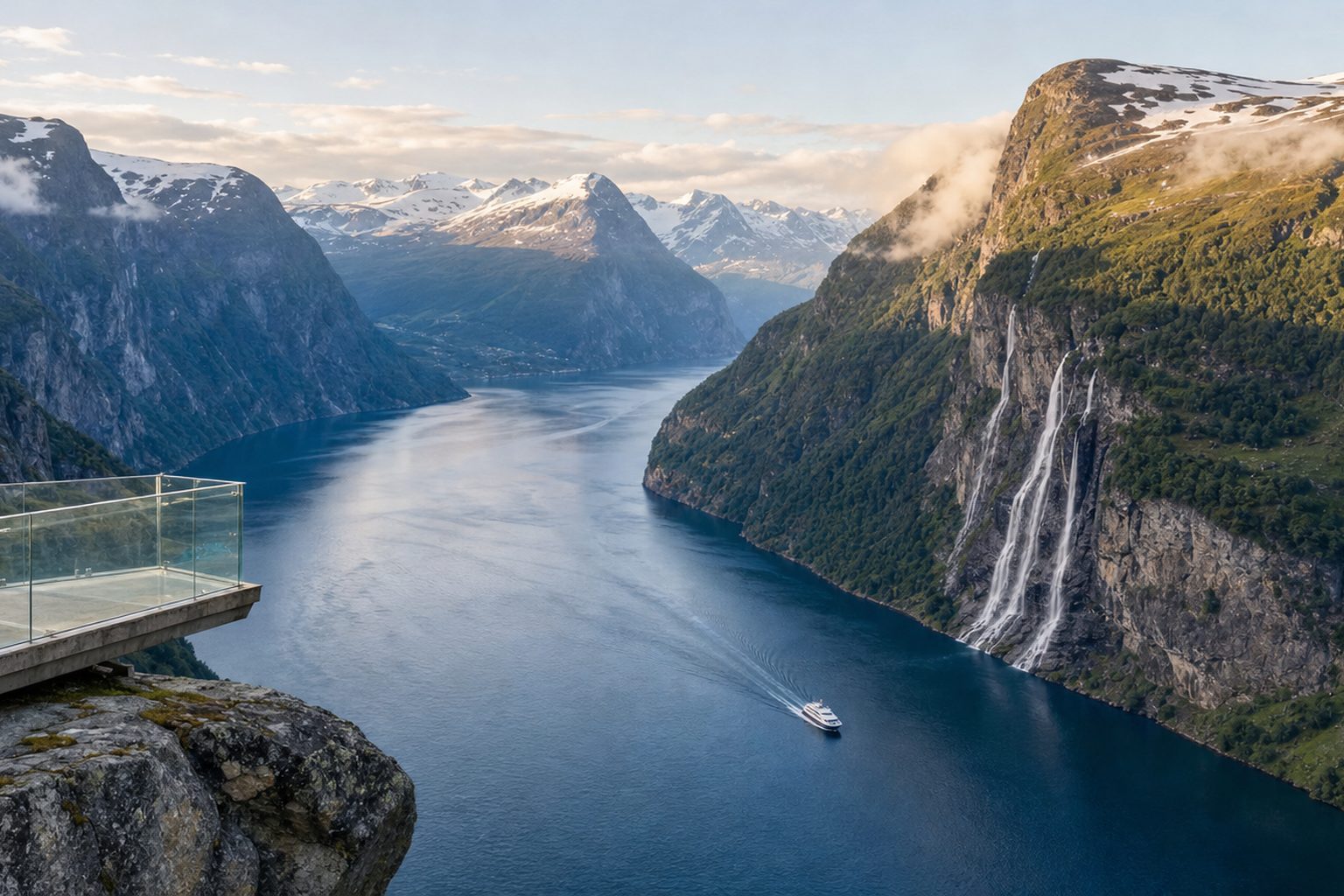
On 1 January 2026, Geirangerfjord became one of the first places on earth to tell ships, in law, to go clean. Passenger vessels under 10,000 gross tons — the sightseeing boats, tourist ferries and small expedition ships that thread the fjord all summer — must now operate without direct emissions of carbon dioxide or methane while they are inside the World Heritage fjords. The S-shaped, fifteen-kilometre arm of blue water below the Seven Sisters waterfall has not changed; what has changed is the sound of it. The boats that carry you past the falls are now largely electric, and the fjord is quieter for it.
For a first-time visitor, the decisions are pleasingly few but worth getting right: whether to cross the fjord by the public car ferry or a dedicated sightseeing boat, which of the two great road viewpoints — Dalsnibba high above the valley or Ørnesvingen on the Eagle Road — to build the driving day around, and when in the short western Norwegian season to come at all. This guide works through each choice with 2026 prices and dates, all checked in August 2026, and explains what the new emission rule does and does not mean for your trip.
What the zero-emission rule actually changes
The rule comes from the Norwegian parliament's long-standing ambition to protect the West Norwegian Fjords World Heritage site, and it is administered under a regulation on environmental safety for ships and floating installations. In plain terms: from 1 January 2026, passenger ships below 10,000 gross tons may only use energy sources that produce no direct CO2 or methane emissions while in the protected fjords, with a narrow allowance for biogas and for pilot fuels used to ignite an engine. Ships must also use shore power where it is available. The details are set out by the Norwegian government and the Norwegian Maritime Authority.
From 1 January 2026, passenger ships under 10,000 gross tons must use energy sources with no direct CO2 or methane emissions in Norway's World Heritage fjords; ships of 10,000 gross tons and above must comply from 1 January 2032. [2]
The threshold matters because it splits the fjord's traffic in two. The small and mid-sized boats you are most likely to board — the Geiranger–Hellesylt ferry, electric sightseeing vessels, kayak-support boats — fall under the 2026 requirement and have converted. Large cruise ships over 10,000 gross tons have a transition period until 1 January 2032, so conventional liners will continue to anchor off Geiranger through the 2031 season. If you were hoping the village would empty out overnight, it has not: Geiranger remains a major cruise port for now, and the busiest hours of a summer day still track the cruise calendar. What the rule guarantees is that everything smaller is already running clean, and that the long-term direction of the fjord is set.
How to see the fjord from the water
The fjord's defining experience costs less than most visitors expect, because the classic sightseeing route is also a public transport link. The Fjord1 car ferry between Geiranger and Hellesylt runs the full length of the fjord in about 65 minutes, passing directly beneath the Seven Sisters waterfall and its counterpart across the water, the Bridal Veil. It carries cars, campervans, bicycles and foot passengers, and the crossing doubles as a narrated fjord cruise. In 2026 the timetable runs from April into October, with the fullest schedule — up to eight or nine departures a day each way — between 1 June and 13 September; see the Fjord1 timetable before you commit to a driving route that depends on it.
As checked in August 2026, traveller fares start from about NOK 390, while vehicle fares are priced by length and season and should be confirmed against Fjord1's current price list. One car package covers the vehicle, the driver and up to four passengers, which makes the ferry the obvious value for families driving the Rv63 loop. Operator guidance asks vehicles to check in 30 minutes before departure and foot passengers 15 minutes before, and notes that bookings can be changed or refunded free of charge up to 48 hours ahead — details on the official route page.
Travelling by water is also how the fjord earned its protection in the first place. The West Norwegian Fjords — Geirangerfjord together with Nærøyfjord, 120 kilometres to the south — were inscribed by UNESCO in 2005 for their exceptional natural beauty and as textbook examples of how glaciers carve a coastline. From a boat, mid-fjord, the logic of the listing is self-evident: rock walls rising sheer from the sea, farms abandoned on ledges, and waterfalls that fall so far they arrive as mist.
The West Norwegian Fjords — Geirangerfjord and Nærøyfjord property covers 122,712 hectares and is inscribed on the World Heritage List under criteria (vii) and (viii) for superlative natural phenomena and outstanding geological values. [3]
Dalsnibba and the Geiranger Skywalk
Of the two headline viewpoints, Dalsnibba is the high one. The Geiranger Skywalk sits at roughly 1,500 metres above sea level on the summit of Dalsnibba, looking straight down the Geirangerdalen valley to the fjord — a view that takes in snowfields, the winding Rv63 and the water in a single frame. You reach it on the Nibbevegen, a private toll road that climbs from Djupvatnet lake at 1,030 metres through eleven hairpins at a ten per cent incline. The platform's glass railing keeps the drop honest. Snow lines the road well into June, and the road is seasonal — open roughly May to October depending on conditions, so check the official Geirangerfjord site before driving up in the shoulder months.
As checked in August 2026, the Nibbevegen toll road to the Geiranger Skywalk at Dalsnibba costs NOK 380 per car and NOK 180 per motorbike, climbing eleven hairpins from Djupvatnet (1,030 m) to the 1,500-metre summit. [7]
Two practical notes. First, the weather at 1,500 metres keeps its own schedule: a clear morning in Geiranger village can be a wall of cloud on the summit, so treat Dalsnibba as a fair-weather call you make on the day rather than a fixed appointment. Second, the toll is charged per vehicle, not per person, which changes the arithmetic for a full car versus a solo motorbike. If you are travelling without a car, seasonal sightseeing buses run up from the village in summer; enquire locally, as schedules shift year to year.
Ørnesvingen and the Eagle Road
The other essential viewpoint is free. Ørnesvingen — the Eagle Bend — is the topmost of eleven hairpins on Ørnevegen, the Eagle Road, the stretch of Rv63 that climbs out of Geiranger towards Eidsdal. The road opened in 1955 and finally gave Geiranger year-round road access; its name comes from the eagle territory the highest bends pass through. At about 620 metres, a platform with a glass-floored section hangs over the classic postcard composition: the village and its harbour below, the fjord curving away west, and the Seven Sisters streaming down the far wall. The viewpoint was rebuilt as part of Norway's national scenic-routes programme and reopened in 2006, as Visit Norway records.
It is around seven kilometres from the village — twenty to thirty minutes of low-gear driving — and the parking area is small, which is the only real catch. On cruise-ship days the pull-in fills quickly from mid-morning, and stopping on the hairpin itself is neither legal nor wise. Go before 09:00 or in the long evening light, when the tour coaches have gone and the fjord below holds the last sun. Drivers continuing north should note that the Eagle Road is the start of the larger Geiranger–Trollstigen scenic route, and that Ørnesvingen works as naturally at the start of a driving day as at the end of one.
When to go and how to time the day
Geiranger's season is short and steep. High summer — mid-June to mid-August — brings reliable openings of everything in this guide, the fullest ferry timetable, waterfalls at their strongest from snowmelt, and the biggest crowds, cruise calls included. The shoulder weeks either side, from late May and into September, trade a little certainty for a lot of calm: the ferry still runs, Dalsnibba is usually open, and the village breathes between ship visits. Outside roughly October to April, the high road over to Dalsnibba closes, ferry sailings thin to nothing, and the fjord returns to the few hundred people who live on it.
The Geirangerfjord and Nærøyfjord areas are among the most scenically outstanding fjord landscapes on the planet, remarkable for sheer rock walls that rise directly from the sea, free-falling waterfalls and glacier-carved scale.
— Paraphrased from the UNESCO World Heritage listing
- Check the cruise-ship calendar for Geiranger before fixing your dates — the village's rhythm follows ship arrivals more than the weather.
- Reserve the Geiranger–Hellesylt ferry ahead if crossing with a vehicle; foot passengers rarely need to.
- Hold Dalsnibba as a flexible, clear-weather slot rather than a fixed morning; the NOK 380 toll buys the view only if the cloud lifts.
- Visit Ørnesvingen before 09:00 or after 18:00 to have the platform close to yourself.
- Carry a card, not cash — ferries, tolls and car parks in the fjords are effectively cashless.
Getting there and where the fjord fits
Geiranger is reached by the Rv63 from the north via the Eagle Road and the Eidsdal ferry link, from the south over the high Dalsnibba plateau road from Langvatnet, or by water from Hellesylt on the car ferry. There is no railway and no airport in the valley; most independent travellers drive, arriving from the Ålesund area or as part of a longer western-fjords road trip. The mountain approaches are seasonal, and in winter the fjord can be effectively a dead end by road, so late-autumn and spring itineraries should be built around the ferry and the lower approaches. If you are stitching Geiranger into a bigger European rail-and-drive plan, our overview of how to travel around Europe covers the ferry-and-car logic that Norway rewards.
Give the fjord a minimum of one full day and one night. Day-trippers see the water and one viewpoint; an overnight adds the other viewpoint in better light, an evening village that has emptied of coaches, and a morning crossing on a quiet deck. Two nights lets you add a farm hike — Skageflå, the ledge farm above the fjord, is the classic — or simply repeat the ferry in the opposite direction, which is no hardship at all.
The zero-emission rule gives Geirangerfjord a distinction no brochure can manufacture: it is now a place where the way you arrive is part of what is being protected. Seen from the Skywalk or the Eagle Bend, the first electric summers will look much as the fjord always has — which is exactly the point. If Norway's quieter corners are the draw, carry the momentum north to Senja's sharp coastal ridges or the better-known drama of the Lofoten Islands, both of which reward the same unhurried, seasonal planning that Geiranger teaches.
Sources & further reading
- 1. Norwegian Government — zero-emission requirements in the World Heritage fjords
- 2. Norwegian Maritime Authority — regulation on environmental safety in the World Heritage fjords (PDF)
- 3. UNESCO World Heritage Centre — West Norwegian Fjords: Geirangerfjord and Nærøyfjord
- 4. Fjord1 — Geiranger–Hellesylt timetable 2026 (PDF)
- 5. Norway Geirangerfjord Cruise — Hellesylt ferry fares and booking
- 6. Norway's Best — fjord cruise Geirangerfjord (Geiranger–Hellesylt)
- 7. Geirangerfjord.no — Geiranger Skywalk Dalsnibba (official)
- 8. Visit Norway — Ørnevegen, the Eagle Road