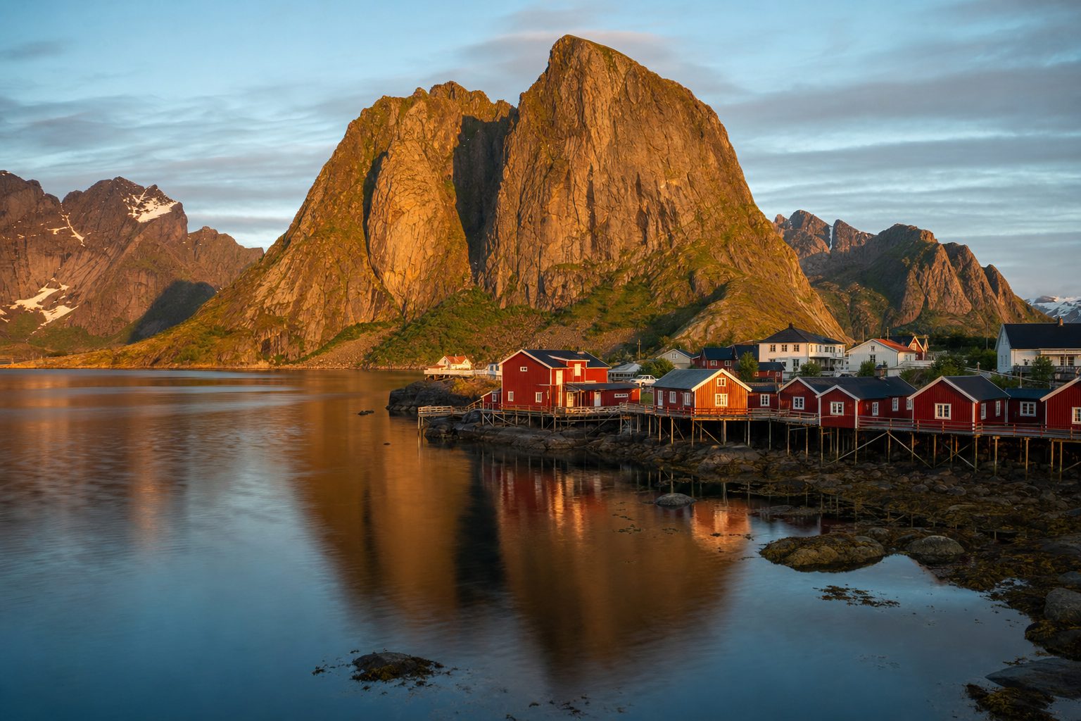
The Lofoten Islands sit above the Arctic Circle off Norway's northwest coast, a chain of granite peaks that rise almost directly out of the Norwegian Sea behind a scatter of red fishing villages. The postcard image, usually Reine or Hamnøy with their rorbu cabins on stilts over the water, is real, but the trip that produces it depends on decisions made weeks in advance: which season you choose, how you get a car onto the islands, where you base yourself, and how you plan around a road network built for fishing traffic rather than tour buses.
This guide sets out those decisions in order, using the operators' own current guidance rather than recycled blog advice, so the choice between a midnight-sun June and a northern-lights November is made with the actual dates, prices, and booking rules in hand.
Choosing your season: midnight sun, northern lights, or the quiet shoulder
Lofoten runs two opposite light shows, and they do not overlap. In summer the sun does not dip below the horizon; in winter, darkness is the backdrop for the aurora. According to Visit Lofoten's midnight sun guide, the sun stays above the horizon from 28 May to 14 July across most of the archipelago, though the exact window shifts by a few days depending on location, with Uttakleiv on the west coast seeing it from 25 May to 18 July. Outside that window the sky still barely darkens through most of summer, so late May and early August remain bright even without a true midnight sun.
As checked in July 2026, Visit Lofoten states the midnight sun is visible across the islands from 28 May to 14 July, with the exact dates varying slightly by location. [4]
Northern lights season runs on the calendar's other half. Visit Lofoten's aurora guide notes that the lights are typically visible from late August through mid-April, which the operator frames as roughly eight months of the year, with activity usually appearing between about 20:00 and just after midnight under clear, dark skies. A clear sky matters more than the calendar date, and a full moon or overcast weather can wash out a display regardless of solar activity.
Getting onto the islands: flights, the E10, and the Bodø-Moskenes ferry
Most visitors reach Lofoten through Bodø or the Harstad/Narvik airport at Evenes, then continue by road, air, or sea. Visit Norway's Lofoten page puts the drive from Evenes to the islands at two and a half to four hours, and notes daily car ferries running year-round from Bodø to Moskenes, Værøy, and Røst, alongside express passenger boats. Driving in via Sweden is also possible: Visit Lofoten's driving guide describes the E10 running the full length of the archipelago, covering 163 km between Fiskebøl in the north and Å in the south, crossing a string of bridges and roughly half a dozen tunnels, including a 1,776-metre undersea tunnel at Nappstraumen.
As checked in July 2026, the Bodø-Moskenes ferry operator allows booking or reserving up to 60% of a departure's capacity in advance, up to 10 hours before sailing, with reserved bookings for a car requiring arrival at the dock at least 45 minutes before departure. [3]
That last point matters for anyone planning a tight schedule: the Bodø-Moskenes crossing is not guaranteed just because you show up, particularly in July and August when demand for vehicle space is highest. Passengers travelling without a car can usually board free and without a booking, but a car deserves a pre-paid reservation, made through the operator's own booking system before 20:00 the evening before travel.
Do you need a car, and where should you base yourself
A car is close to essential. Public buses run along the E10 corridor, but the beaches, trailheads, and viewpoints that define Lofoten's scenery sit well off that spine, and departures thin out fast outside the main towns. Most visitors split their stay between one or two bases: Svolvær in the east, the archipelago's largest town and a hub for boat tours into Trollfjorden, and Leknes or the villages around Reine further west, closer to the dramatic Moskenesøya peaks that dominate every Lofoten photograph. Renting from Bodø or Evenes airport before crossing tends to widen the choice of vehicles and lower the daily rate compared with the smaller counters at Svolvær or Leknes airports, both served only by short-hop regional flights.
For a first visit of five to seven days, one base in the Reine-Hamnøy area covers the western highlights, including a similarly dramatic North Atlantic seascape in spirit if not geography, while a second night or two in Svolvær or nearby Henningsvær adds the fishing-harbour atmosphere and easier access to Trollfjorden boat trips.
Staying in a rorbu, and controlling costs with a kitchenette
The traditional lodging is a rorbu, a fisherman's cabin built on piles over the water, originally used by seasonal cod fishermen and now converted for overnight stays around villages like Reine, Hamnøy, Nusfjord, and Svolvær's Svinøya. Most rorbu units for rent today include a small kitchenette, which matters in a country where restaurant meals routinely run well above what most European visitors are used to paying. Buying groceries at the supermarkets in Leknes, Svolvær, or Reine's outer harbour and cooking two or three dinners in the cabin is standard practice for travellers managing an Arctic Norway budget over a week or more.
Visit Lofoten frames the archipelago's appeal as the meeting of everyday local life with global interest in its natural beauty, describing the islands as a place where mountains meet the sea rather than a staged backdrop.
— Paraphrased from the official Visit Lofoten travel guide
Hiking Reinebringen: the trail, the steps, and where to actually park
The single most photographed viewpoint in Lofoten sits atop Reinebringen, the peak immediately behind Reine, reached by a stone staircase of roughly 1,970 to 2,000 steps built into the mountainside by Nepalese Sherpa crews to control erosion from the trail's popularity. Visit Norway's official listing rates the hike as medium difficulty, warns that sections are steep and exposed, and states plainly that it is not recommended for young children or in winter conditions, noting that rescue teams have had to assist stranded visitors.
As checked in July 2026, Visit Norway describes the Reinebringen trail as medium difficulty with steep, exposed sections, recommends it only once winter snow has cleared, and advises against attempting it with young children. [5]
Parking is the part visitors most often get wrong. Reine itself is now a fully enforced no-parking zone outside marked lots, with roadside stops on the E10 drawing fines. The nearest free option is a small gravel area at Djupfjord, often labelled Steffenakken on maps, about 1.3 km south of the trailhead along the E10, though it fills early in summer and is popular with campervans. Paid alternatives sit closer to the village centre: Reine's outer harbour car park and the Reine Kulturhus both charge by the hour or offer a flat day rate, and Visit Norway's own listing directs hikers to start from the outer harbour car park regardless of season.
- Park only in marked lots: Djupfjord/Steffenakken (free, fills early), Reine outer harbour, or Reine Kulturhus (both paid by the hour or day).
- Never stop along the E10 itself or inside Reine's no-parking zone; enforcement is active and fines apply.
- Start early morning or go in the evening during midnight sun season to avoid the steepest crowding on the stairs.
- Carry sturdy shoes, a windproof layer, and water; the official guidance flags exposed, airy sections near the summit.
- Skip the hike entirely once snow and ice arrive; it is not a winter route.
Hamnøy, Henningsvær, and the villages worth slowing down for
Hamnøy, a few minutes from Reine by the E10, is the small fishing settlement behind the single most reproduced Lofoten photograph: a cluster of red rorbu cabins on the water with the jagged Olstind ridge behind them, best seen from the bridge connecting Hamnøy to the mainland side of the fjord. Further east, Henningsvær occupies its own tiny cluster of islets linked by causeways, with a working harbour, a scattering of galleries and cafés, and a football pitch wedged between the rock and the sea that has become a minor landmark in its own right. Both villages are compact enough to walk in under an hour, which makes them easy to combine with a longer day built around the E10's National Tourist Route, a signed 230 km stretch from Raftsundet in the north to Å in the south with dedicated viewpoints and picnic stops along the way.
None of these villages has meaningful public parking capacity for peak-season coach traffic, so arriving early or late in the day remains the most reliable way to photograph them without a car park in the frame.
Weather, water temperature, and what to actually pack
Lofoten's climate runs milder than its latitude suggests, moderated by the Gulf Stream, but conditions change quickly on an exposed archipelago in the open Norwegian Sea. Wind and rain can arrive with little warning even in July, and the same exposed ridgelines that make the hiking dramatic also make it genuinely hazardous in poor visibility. Layered clothing, a proper waterproof shell, and boots with real grip are standard advice from every official source, not seasonal marketing. Sea temperatures stay cold enough that any beach visit is typically about the sand and the view rather than a swim, though the pale sand at beaches like Kvalvika and Haukland photographs closer to the tropics than the Arctic on a clear day.
Building the trip: a realistic first-time itinerary
For a first visit, five to seven days is enough to cover both ends of the archipelago without rushing the drive. A common pattern lands in Bodø or Evenes, picks up a car, crosses to Moskenes or drives in via the E10, bases two to three nights around Reine or Hamnøy for the western peaks and Reinebringen, then relocates to Svolvær or Henningsvær for boat trips and the eastern half of the National Tourist Route before flying out. Travellers extending a longer Nordic trip sometimes pair Lofoten with a wider look at Iceland's Ring Road for a second Arctic-adjacent landscape, or treat it as one stop on a broader Arctic and adventure travel list alongside Svalbard or the Faroes.
The archipelago rewards patience over a checklist: weather dictates the hiking, ferries dictate the itinerary, and the villages are small enough that a wrong-season visit shows immediately in overflowing car parks rather than empty ones. Anyone weighing Lofoten against Norway's other island chains might also look at the Faroe Islands, a shorter flight from much of Europe with its own strict access rules and comparably dramatic cliffs, before settling on which Arctic archipelago fits the trip.
Sources & further reading
- 1. Visit Lofoten: The Lofoten Islands, Norway (official travel guide)
- 2. Visit Norway: The Lofoten Islands
- 3. Torghatten Nord: Bodo-Vaeroy-Rost-Moskenes ferry route and booking
- 4. Visit Lofoten: Midnight Sun in Lofoten
- 5. Visit Norway: Hike to Reinebringen (484 m.o.s.)
- 6. Visit Lofoten: When, Where, How to See the Northern Lights
- 7. Visit Lofoten: Drive to Lofoten with Rental Car or Your Own Car
- 8. Visit Norway: Lofoten in Winter