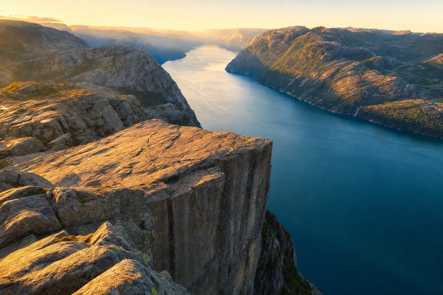
The photograph that brings most people to Preikestolen is honest, for once. The Pulpit Rock really is a flat granite shelf jutting out of a cliff face 604 metres above Lysefjord, and there really is no fence, no railing and no barrier of any kind between the plateau and the drop. What the photograph does not show is the queue behind the camera on an August midday, or the decisions that separate a calm morning on the rock from a crowded, cloud-bound one.
Those decisions are few, and none of them involves a permit. Unlike the lottery-guarded ridge at Angels Landing in Zion, Preikestolen is free to hike under Norway's right to roam: you simply park, or step off a bus, and walk. What you are really deciding is when to start, how to get to the trailhead from Stavanger, what the weather is doing, and whether to add the fjord itself — by cruise from Stavanger, or on the harder hike to Kjerag further up the same water. This guide takes those choices in order.
A flat slab 604 metres above the fjord
Preikestolen sits in Strand municipality in Rogaland, on the north side of Lysefjord, a 42-kilometre glacial cut in the southwest corner of Norway. The plateau itself is a near-level square of granite roughly 25 metres on a side, formed by frost wedging along the rock's natural joints. Geologists have mapped a visible crack where the outer block will, in some distant epoch, part company with the mountain; monitoring has found no sign that this is imminent, and the site remains open without restriction.
The cliff rises 604 metres (1,982 ft) above Lysefjorden. The trail starts at Preikestolhytta at about 270 metres above sea level and runs roughly 3.8 kilometres each way; the path was rebuilt by Nepalese Sherpas in a project that began in 2013. [5]
The exposure is the point, and it is worth being clear-eyed about it. The edge is open because Norwegian outdoor culture treats visitors as adults: the national convention is to manage risk through judgement rather than infrastructure. People sit with their legs over the drop; nobody will stop you doing the same, and nobody will catch you either. Accidents are in fact rare, but the plateau demands the same respect you would give any unfenced cliff in wind, rain or crowds.
The hike, honestly described
The round trip from the Preikestolen BaseCamp car park is about eight kilometres with roughly 500 metres of total ascent — more than the simple difference in altitude suggests, because the path climbs and descends several ridges on its way. Most walkers take four to five hours including a proper stop on the plateau; the fit and unburdened do it in three. Fjord Norway, the regional tourism board, calls the walking time about two hours each way for people used to rough terrain, and honestly notes that children and less experienced hikers should expect longer.
The trail is graded moderate and is well built: long sections are stone-stepped thanks to the Sherpa teams who rebuilt the route, and the way is marked throughout with the red T of the Norwegian Trekking Association. That does not make it a stroll. The first kilometre climbs steeply from the car park, there is a boulder field in the middle section, and the final approach traverses an open ledge above the fjord. Good footwear with real tread matters more here than technical gear; trainers with worn soles are the most common mistake on the mountain.
The main season runs from May to October. Outside it, snow and ice make the route a different proposition — Wikipedia's plain summary is that the hike is not always possible in winter — and from late autumn the safe option is a guided winter walk with the local operators rather than an independent attempt.
Getting there: the tunnel, the bus and the parking bill
The trailhead is about a 40-minute drive from Stavanger, and the journey is a minor engineering pilgrimage in its own right: the road crosses under the Horgefjord through the Ryfylke Tunnel, part of the Ryfast link that replaced the old Tau ferry in 2019.
The Ryfylke Tunnel is 14.4 kilometres long and reaches 292 metres below sea level, making it the world's longest subsea road tunnel and the deepest tunnel of any kind. [6]
Until 2019 this crossing meant a ferry from Stavanger to Tau, and older guidebooks still frame the trip that way; the ferry question has since been answered by the tunnel, which runs around the clock and cut the journey to as little as half an hour. Drivers follow road 13 signs from Stavanger, exit the tunnel at Solbakk, continue on road 523 through Jørpeland, and take the signed exit to Preikestolen Parking three kilometres beyond the town. The car park at BaseCamp holds 1,000 cars and has 20 charging stations, and it fills on fine summer mornings — arriving after nine can mean circling or being turned away to overflow options much further out.
As checked in August 2026, parking at Preikestolen is free for under 15 minutes, 40 NOK for up to two hours and 275 NOK for a hiker's full day, paid at the machine by number plate before you leave. [3]
Without a car, the direct buses are straightforward but rule-bound. Two operators — Pulpit Rock Tours and Go Fjords — run from Stavanger to the trailhead in about 50 minutes, through the same tunnel. As checked in August 2026, high summer (roughly 20 June to mid-September) sees up to nine departures a day, thinning to a couple of morning runs in spring and autumn; return fares start around 498 NOK. Tickets must be bought online in advance, cannot be bought on board, and are not transferable between operators, so your return leg must be with the company that brought you. In the low season there are no direct buses at all: the workaround is the public bus 100 to Jørpeland and a ten-minute taxi from there.
There is also a case for not day-tripping at all. Preikestolen BaseCamp, the lodge complex at the trailhead — its car park owned and run by the non-profit Stiftelsen Preikestolen — offers rooms, cabins and lakeside glamping, and overnight guests park free. Sleeping at the trailhead is the single most reliable way to be first on the path, an advantage no bus timetable can match, and one that turns the mountain's busiest weeks into a private early morning.
When to start
Preikestolen's problem is arithmetic, not difficulty. More than a quarter of a million people walk the same 3.8 kilometres each year, and most of them start between nine and eleven in the morning, because that is when the buses, cruise-ship excursions and holiday routines deliver them. The plateau at one in the afternoon in July is a patient queue for photographs; the same rock at seven in the morning can be close to empty.
The choice, then, is simple. Drive or take the earliest bus and be walking before eight, and you will meet the crowds coming up as you come down. Or invert the day: in June and July, when daylight in Rogaland stretches past ten at night, a late-afternoon start puts you on the plateau in golden light with the day-trippers long gone — carry a headlamp for the last of the descent as insurance. Shoulder months are kinder still: May and September keep the trail open and the light good while cutting the traffic, at the price of less reliable weather.
- Boots or trail shoes with solid grip — the granite is polished and slick when wet
- A windproof and warm layer, whatever the forecast in Stavanger says
- Water and a packed lunch; there are no facilities beyond the trailhead
- A headlamp for early starts or late returns outside high summer
- The Yr.no forecast for Preikestolen itself, checked the morning you walk
Weather, safety and the unfenced edge
The mountain's weather is not Stavanger's. Cloud can sit on the plateau while the city is sunny, and wind at the edge is always a category stronger than wind at the car park. The rule the local guides repeat is unglamorous and correct: if visibility drops or the wind gets up, turn back — the rock has stood for ten thousand years and will still be there on a better day. There is no barrier at the edge and no warden on the summit; the margin for error is exactly as wide as you make it.
The plateau towers some 600 metres above Lysefjord and draws more than 250,000 walkers a year; allow about two hours each way if you are used to rough terrain, longer with children, and bring hiking boots, warm clothes, food and drink.
— Paraphrased from Fjord Norway, the region's official tourism board
Keep children within arm's reach on the final ledge and the plateau, stay well back from the lip in gusts, and resist the temptation to back towards the edge for a wider photograph — the standard advice is to sit down before you get close. None of this is meant to put you off. It is meant to keep the visit what it should be: a serious, straightforward mountain walk to one of the most extraordinary viewpoints in Europe. Mobile coverage on the trail is good by mountain standards, the path is busy enough in season that help is rarely far away, and the emergency number in Norway is 112 — but the best safety equipment remains the willingness to turn around before the mountain makes the decision for you.
Seeing Lysefjord from the water — and the harder sibling upstream
The classic pairing is to look down from the rock one day and up at it the next. Sightseeing boats run from Stavanger's harbour into Lysefjord year-round, passing directly beneath the Preikestolen wall — from the deck, the shelf you stood on becomes a barely visible notch in a 600-metre cliff, which is the point. Ferries and fjord cruise options are listed on the official Lysefjord visitor site at lysefjorden365.com, and combining a morning cruise with an afternoon hike, or the reverse, is a well-worn Stavanger day.
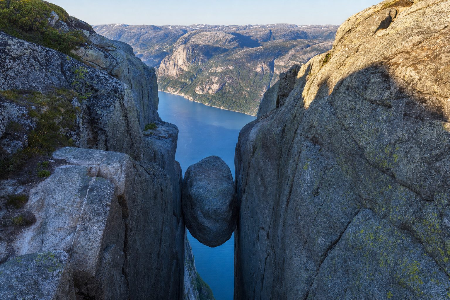
Kjerag, further up Lysefjord, hangs 1,000 metres above the water; the round-trip hike is 11 kilometres, takes roughly 5–6 hours, and its trailhead parking is seasonal, reopening in May. [7]
Kjerag is the escalation for those who found Preikestolen busy or brief: a tougher, chain-assisted walk to the boulder of Kjeragbolten, wedged in a crevice above a kilometre of air. Both hikes are now certified Norwegian Scenic Hikes, and both belong to the same argument — that western Norway's best moments are earned on foot. If this is the beginning of a longer Norwegian itinerary, the natural next chapters are the ferry-laced valleys of Geirangerfjord, the road-trip arc of the Lofoten Islands, or the quieter ridgelines of Senja — each a different answer to the question Preikestolen asks from its unfenced edge: how close to the drop do you want to stand?
Sources & further reading
- 1. Preikestolen BaseCamp — plan your trip (official trailhead operator)
- 2. Preikestolen 365 — how to get to Preikestolen (official visitor site)
- 3. Preikestolen 365 — parking at Preikestolen (official visitor site)
- 4. Fjord Norway — bus to Preikestolen (official regional tourism board)
- 5. Wikipedia — Preikestolen
- 6. Wikipedia — Ryfylke Tunnel
- 7. Lysefjorden 365 — Kjerag (official Lysefjord visitor site)