Madeira's reputation online rests on a handful of images: a knife-edge ridge between two peaks lost in cloud, a mossy lagoon fed by twenty-five separate streams, a tunnel lit only by headlamp. Getting any of these requires fewer heroics than the reels suggest, but it does require decisions made before you land. The trails are managed, several now require a paid time-slot booking, one of the most famous has become one-way, and the island's weather splits sharply between a dry south coast and a wet, forested north. None of this is a reason to avoid Madeira's levadas, the centuries-old irrigation channels and the footpaths that run beside them. It is a reason to choose a base, book trail slots in advance, and pick one route per day rather than trying to stack summits and waterfalls into a single itinerary.
The core choices are straightforward once laid out: whether to chase the ridge walk between Pico do Arieiro and Pico Ruivo or stay lower on a forest levada, whether to base in Funchal or push out to the north coast, and how much of each day to leave free for the mountain weather to change its mind. The rest of this guide works through each of those decisions in turn.
Choosing between the ridge trail and a levada walk
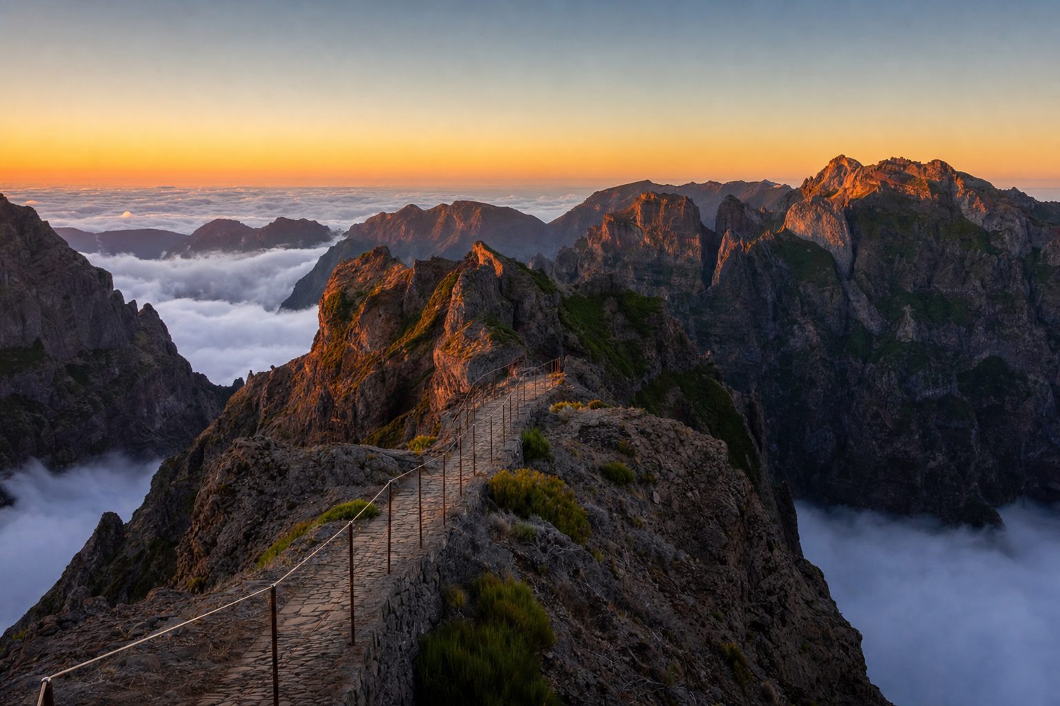
Madeira's trail network splits into two families. The veredas, including the famous PR1 Vereda do Areeiro, are mountain ridge paths that connect the island's highest points; the levadas follow the near-flat irrigation channels built from the 1500s onward to carry water from the wet north to farmland in the drier south. PR1 links Pico do Arieiro, at 1,818 metres, with Pico das Torres and the island's summit, Pico Ruivo, at 1,862 metres, via a rock-cut path with tunnels and exposed stairways. It is Madeira's signature hike and also its most demanding: expect two and a half to three and a half hours of walking one-way, roughly 1,000 metres of combined ascent and descent, and no shortage of drops beside the path. Levada walks such as PR6 (Levada das 25 Fontes) and PR9 (Levada do Caldeirão Verde) are gentler by comparison, following the near-level water channel through laurel forest to a waterfall or lagoon, with one or two tunnel sections and far less exposure. A realistic plan uses PR1 as the one big mountain day and treats levada walks as the lower-effort days either side of it.
Pico do Arieiro sits at 1,818 metres and is the starting point of the Vereda do Areeiro (PR1), according to the official Visit Madeira trail listing. [1]
Booking PR1, PR6 and PR9 before you go
As checked in July 2026, Madeira's most-used classified trails, including PR1, PR6 and PR9, require an advance reservation and paid ticket through the regional government's SIMplifica portal, with entry checked against a time slot at the trailhead. This replaced the old walk-up system and now applies to residents and visitors alike, so booking is not optional even for a short detour. Fees for a standard classified trail run €4.50 per adult; PR1's full one-way route from Pico do Arieiro to Pico Ruivo is priced separately, since it now covers a longer, harder circuit than the older short section. Children under 12, Madeira residents, and visitors with a recognised disability are exempt from the charge but must still be registered in the booking. Multi-day passes exist for combining several standard trails across one, three or seven days, but they do not cover PR1, which always needs its own reservation.
PR1's one-way rule and what it means for logistics
The rule that catches out the most first-time visitors is that PR1 now runs one-way. As checked in July 2026, the trail can officially only be started at Pico do Arieiro and walked toward Pico Ruivo; walking the reverse direction is no longer permitted, with the exception of the initial roughly 1.2 km stretch to the Pedra Rija viewpoint, which remains open in both directions for anyone who only wants a short there-and-back walk. This means your car stays at the Arieiro car park while you finish tens of kilometres away, at either Achada do Teixeira (via the PR1.2 descent) or Ilha (via PR1.1), so you need transport arranged before you set off: a second driver, a taxi booked in advance, or a guided transfer that handles the return leg. Full opening days and the one-way pattern have shifted across 2026 as maintenance work finished in stages, so the sensible step is to check the current status and any weekday restrictions on the Institute of Forests and Nature Conservation (IFCN) website in the days before you hike, not the week before your flight.
As checked in July 2026, PR1 operates as a one-way route from Pico do Arieiro to Pico Ruivo, with two-way access preserved only on the short initial section to the Pedra Rija viewpoint, per SIMplifica trail booking guidance referencing IFCN rules. [5]
Vereda do Areeiro is described as a trail connecting three iconic spots in Madeira, beginning at Pico do Arieiro, crossing Pico das Torres, and ending at Pico Ruivo.
— Paraphrased from the Visit Madeira official trail listing for PR1
Sunrise at Arieiro without the parking problem
The image of Pico do Arieiro's summit rising above a sea of cloud is one of Madeira's most shared, and it draws a genuine crowd. The car park at the peak fills early in the warmer months, often well before the 6am mark in summer, which leaves latecomers parking along the access road and walking up in the dark. If sunrise is the goal, arrive with margin: aim to be parked by 5.30am between roughly May and September, bring a headlamp for the approach and for the tunnels further along PR1, and dress for temperatures that sit well below whatever Funchal is showing that morning. The mountain café at the summit typically opens later, around 8am, so carry your own hot drink and breakfast. Because the peak's own microclimate can differ completely from the forecast for sea level, check a mountain-specific forecast for Pico do Arieiro rather than the general Funchal outlook before committing to a pre-dawn drive.
Funchal or the north coast: choosing a base
Most itineraries start from Funchal, and for good reason: it has the airport connection, the widest choice of accommodation, and reasonable driving times to trailheads on both the south and central parts of the island, including the roughly 45 to 50 minute drive to the PR6 trailhead at Rabaçal. The trade-off is that the drive to north-coast trails such as PR9's start at Queimadas, or to Porto Moniz and the Fanal laurel forest, eats a meaningful chunk of the day in each direction. A north-coast base, typically around Santana, Porto Moniz or São Vicente, cuts that drive time for levada walks but adds distance back to the airport and to south-coast towns like Câmara de Lobos. The island's microclimates make this more than a convenience question: the north coast receives substantially more rainfall over the year than the sheltered south, so a north-coast base suits travellers prioritising the laurel-forest levadas and willing to accept wetter, cooler mornings, while a Funchal base suits a mixed itinerary of trails, coastal towns and Funchal's own sights. Splitting the trip, a few nights on each coast, is common and avoids the longest repeated drives.
- Pick one levada or ridge trail per day rather than combining two, since transfers, parking and permit slots all take longer than the trail distance suggests.
- Book PR1, PR6, PR9 and any other classified trail slot on SIMplifica as soon as dates are fixed, particularly for weekend and early-morning slots in summer.
- Carry a headlamp for any levada with tunnel sections, including PR6's roughly 800-metre tunnel and PR9's shorter passages.
- Check the IFCN trail status page the day before hiking, since closures for maintenance or weather are common and posted there first.
- Pack layers regardless of the coastal forecast: temperatures and cloud cover at 1,000 metres and above can differ sharply from sea level.
Reading Madeira's microclimates before you pack
Madeira is small enough to drive across in a few hours yet varied enough that a sunny morning in Funchal is no guarantee of clear skies at Pico do Arieiro or at Rabaçal on the Paul da Serra plateau. The island's central mountains catch moisture blown in from the Atlantic, so the north and the high interior stay greener and cloudier while the south coast, in the rain shadow, stays drier and warmer for more of the year. This is the practical reason levada walks in the laurel forest, such as PR9's Levada do Caldeirão Verde, stay walkable through summer when the exposed high routes can be baking or, just as often, closed in by cloud. Pack for both conditions on any hiking day: a light waterproof layer for the forest sections and sudden showers, sun protection for the exposed ridge stretches, and proper footwear, since levada paths are often narrow, sometimes slick with spray, and cut directly into cliff faces.
PR6, Levada das 25 Fontes, is listed by Visit Madeira as one of the island's most popular trails, described on the official page as covering 4.3 km one-way through dense laurel forest to the 25 Fontes lagoon. [2]
PR9, Levada do Caldeirão Verde, is an official IFCN-classified route running from Queimadas through laurel forest tunnels to a waterfall and pool, and is one of the trails requiring a paid SIMplifica reservation, as checked in July 2026. [3]
Driving realities: tunnels, mountain roads and rental cars
A rental car is close to essential for reaching most trailheads outside greater Funchal, since public transport to spots like Rabaçal or Queimadas is limited or nonexistent. The island's road network relies heavily on tunnels, some several kilometres long, cut through the central massif to connect the north and south coasts quickly; these are well-lit and routine to drive but worth expecting if you are unused to mountain tunnel driving. Roads climbing toward Pico do Arieiro and the Paul da Serra plateau are narrow with tight bends and can be shrouded in cloud with little warning, so allow extra time after dark or in poor visibility and keep headlights on throughout. Parking at trailheads is generally free, aside from a small optional shuttle fee at Rabaçal down to the trail café, but arrives at a premium of a different kind: space, not price, is the constraint on popular mornings.
Once the permits are booked and the base is chosen, the rest of a Madeira hiking trip is mostly about pace: one trail a day, a buffer morning for weather, and an early alarm on the day you want the ridge to yourself. Travellers building a longer Atlantic-islands run often pair Madeira with its sister archipelago further north; the guide to São Miguel in the Azores covers a similar crater-lake-and-hot-spring landscape with its own booking quirks, while a broader look at Lisbon and the Algarve or a wider multi-stop European itinerary can help place Madeira's few days of trail time within a longer trip.
Sources & further reading
- 1. Visit Madeira — PR1 Vereda do Areeiro (official trail page)
- 2. Visit Madeira — PR6 Levada das 25 Fontes (official trail page)
- 3. Visit Madeira — PR9 Levada do Caldeirão Verde (official trail page)
- 4. IFCN Madeira — Institute of Forests and Nature Conservation, trail status and rules
- 5. SIMplifica Madeira — official trail booking and fees portal
- 6. Visit Madeira — Pico do Arieiro (official peak page)
- 7. Madeira Hiking Tours — Pico do Arieiro sunrise: guided vs self-drive logistics